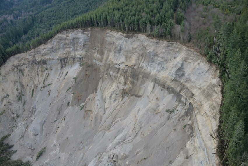
UPDATE: As Washington State braces for a second atmospheric river, mapping efforts to assess landslide risks remain alarmingly incomplete, over a decade after the devastating Oso landslide in 2014. With evacuation orders affecting 100,000 people, the urgency for accurate and comprehensive risk assessments is more critical than ever.
New reports confirm that despite efforts since the Oso disaster, significant gaps persist in the state’s landslide risk mapping. Many residents remain unaware of the vulnerabilities their homes face. As heavy rainfall continues to inundate Western Washington, experts are warning that the lack of updated maps could have dire consequences for public safety.
Joe Smillie, spokesperson for the Washington Department of Natural Resources (DNR), acknowledged the ongoing issues, stating, “It is a knowledge gap and something we are hoping to address.” The DNR has received $23 million since 2016 for a geo-mapping portal aimed at documenting landslide risks across the state, yet much of this project remains unfinished.
Currently, DNR has successfully mapped only a third of the state, identifying between 40,000 and 50,000 existing landslides. Areas such as Pierce County and the Columbia River Gorge are among the few that have received comprehensive mapping for both current and future risks. In contrast, regions like King County have resorted to piecemeal mapping efforts, lacking a cohesive statewide assessment.
The urgency is exacerbated as forecasts predict another storm system to hit on Sunday, following a week of record rainfall. This severe weather pattern increases the potential for shallow landslides, which can be deadly. “We have more rain coming,” warned Kate Mickelson, who leads the state’s landslide mapping team. She emphasized the need for residents to utilize available resources, including state safety guidelines, to stay informed and safe.
While experts like Joe Wartman from the University of Washington recognize that Washington has made strides in mapping since Oso, he pointed out that the necessary granular risk assessments are still lacking. “There is a real advantage to knowing you are in a hazard zone,” Wartman stated, highlighting that awareness can save lives.
In an alarming incident, when Skagit County officials sought DNR assistance for potential landslide risks in Concrete, the mapping technology was down. Though backup data was used to recreate necessary maps, the downtime raises concerns about the reliability of resources during critical times.
As the region prepares for more rain, the DNR and other officials are under pressure to expedite the mapping process. “It will take us many, many years based on the amount of landslides and steep terrain,” Mickelson explained, underscoring the challenges of funding and staffing.
Residents are urged to remain vigilant as the risk of landslides looms. Wartman advises that during intense rainfall, people should be alert to signs such as snapping branches or shifting ground, which may indicate an impending landslide.
“This is not just a matter of mapping,” Wartman concluded. “It’s about protecting lives.”
As Washington grapples with these ongoing challenges, the call for improved mapping technology and risk assessment becomes increasingly urgent. The state must prioritize these efforts to ensure the safety of its residents, particularly as extreme weather events become more frequent.