Historic Tornado Outbreak Threat Intensifies Across Great Plains to Great Lakes
Meteorologists are issuing warnings as a significant and potentially historic severe weather outbreak is forecast to strike the central United States in the final ten days of May. The threat spans from the Great Plains through the Great Lakes, with recent data signaling one of the most active tornado periods seen in over two decades.
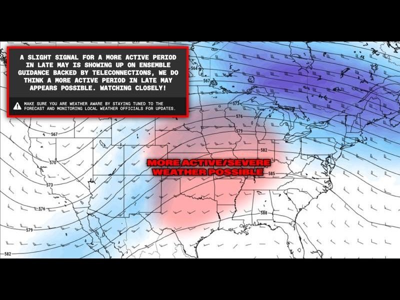
The Euro Ensemble Model, a premier long-range weather forecasting tool, has flagged a powerful atmospheric pattern developing late this month. This pattern strongly resembles the explosive 2004 tornado season, known for its sustained and violent tornado outbreaks across the Great Plains and neighboring regions.
Forecasters emphasize that while any long-range forecast holds uncertainty, the consistency and strength of this signal across multiple model runs demand urgent public attention and preparedness. The Euro Ensemble’s May 7, 2026 run highlights a textbook trough-ridge configuration across the United States, a classic driver for large tornado outbreaks.
Atmospheric Setup Could Ignite Widespread Tornado Activity
This trough-ridge pattern creates critical conditions for severe storms: increased wind shear, abundant moisture transport from the Gulf of Mexico, and strong atmospheric instability. Together, these ingredients provide the energy required for long-track, intense tornadoes capable of widespread damage.
The most volatile zone stretches from the central and southern Great Plains into the Mississippi Valley and up to the Great Lakes corridor. This broad swath of elevated tornado risk endangers millions of residents across multiple states.
Comparison to 2004’s Tornado Season Raises Alarm
The 2004 tornado season remains one of the most prolific in U.S. history, with numerous violent tornadoes spanning several states over weeks. Current model outputs suggest the late May through June period in 2026 could see a similarly sustained outbreak, bringing a serious threat to communities in Colorado’s broader region and beyond.
Local officials and emergency management urge residents to prepare now by reviewing safety plans, confirming weather alert systems work, and closely following forecast updates. The potential for long-duration and widespread tornado activity makes this a critical time for vigilance.
What to Expect Next
Meteorologists expect the risk to escalate in the coming days as the atmospheric pattern evolves. Residents from Colorado to the Great Lakes should monitor forecasts carefully, especially during late May when severe weather often peaks.
State and local emergency services are on alert, and communities are encouraged to stay ready for rapid weather changes. Severe thunderstorms with large hail, damaging winds, and multiple tornadoes are all possible in this developing outbreak.
For ongoing updates and storm analysis nationwide, readers can visit SaludaStandard-Sentinel.com.
“Conditions look increasingly favorable for an intense and prolonged tornado outbreak, possibly matching the infamous 2004 season,” said a lead meteorologist monitoring the Euro Ensemble model data.
This emerging severe weather threat underscores the importance of constant vigilance during peak tornado months and the value of advanced forecasting tools in safeguarding American communities.