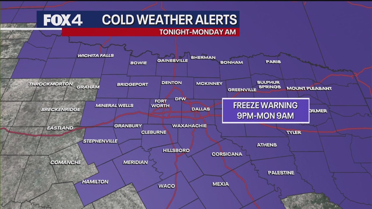
URGENT UPDATE: A Freeze Warning is now active for nearly all of North Texas, starting at 9 p.m. Sunday and lasting until 9 a.m. Monday. The National Weather Service has escalated the previous Freeze Watch due to the imminent arrival of modified Arctic air, marking the coldest temperatures of the season.
Residents must take immediate precautions as temperatures are forecast to plummet overnight. With lows expected to drop to the freezing mark of 32 degrees Fahrenheit in the Metroplex, areas like Denton and Collin counties could see temperatures dip into the upper 20s. Wind chill factors will make it feel even colder, with “feel like” temperatures projected in the upper 20s and low 30s.
Strong northerly winds, ranging from 15 to 25 mph with gusts up to 35 mph, are a significant factor in the rapid temperature drop. These winds will continue through the early hours of Monday, exacerbating the chill. Residents are advised to protect vulnerable plants, bring pets indoors, and wear multiple layers if venturing outside late tonight or early Monday morning.
Despite this frigid weather, relief is on the horizon. A shift to southerly winds is anticipated by Tuesday, driving temperatures back into the mid to upper 70s and even low 80s as the week progresses. However, this warming trend will precede a potential return of rain, with a low chance of showers and thunderstorms expected next weekend.
This sudden cold snap serves as a stark reminder of the unpredictable nature of weather in the region. Stay safe and prepared as North Texas braces for the freeze.