URGENT UPDATE: Indiana braces for a dramatic weather shift as unseasonably warm temperatures give way to severe storms today, December 31, 2023. Forecasts predict potential record highs alongside fierce winds before a swift return to winter conditions by Monday morning.
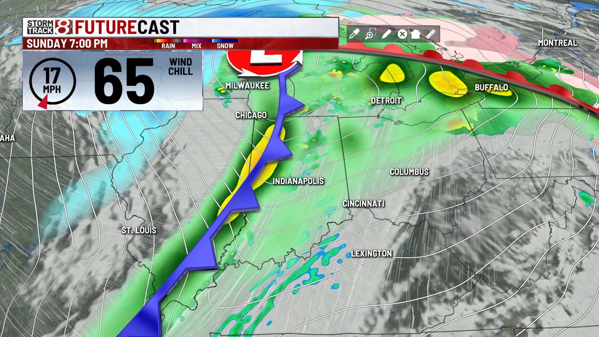
Residents of Indianapolis can expect a final taste of spring-like warmth today, with temperatures climbing into the 60s. This could break the long-standing record high of 65°F set in 1984. However, the pleasant weather carries a catch: a strong cold front is sweeping in, bringing rain and gusty storms.
As the day progresses, showers are anticipated in the morning, with a significant uptick in rain and storm activity expected by the afternoon. Weather experts warn of gusty winds exceeding 50 MPH, posing a Level 1 risk of severe weather for much of the state. While a tornado spin-up is unlikely, the presence of strong wind energy heightens the risks.
Officials caution that the total rainfall could range from 1/4 inch to 3/4 inch, leading to potential flash flooding in low-lying areas. As night falls, temperatures will plummet rapidly, dropping below freezing by the Monday morning commute. This may cause slick road conditions as leftover water from today’s rains freezes overnight.
Residents are advised to remain vigilant, as isolated snow showers could develop on the back edge of the departing storm system, although significant accumulation is not expected.
Looking ahead to tomorrow, January 1, 2024, expect cold and blustery conditions, with temperatures settling in the 20s and wind chills plunging into the teens or colder. Snow flurries may occur, particularly north of Indianapolis, as the harsh winter weather begins to set in.
As we approach the New Year, the forecast predicts a quieter day on Tuesday, January 2, but colder air remains on the horizon. Residents should prepare for a brisk New Year’s Eve, with temperatures reaching the upper 30s and the potential for light snow late into the night.
Stay tuned for further updates as this developing weather situation unfolds. For real-time alerts, follow local news sources and weather reports.