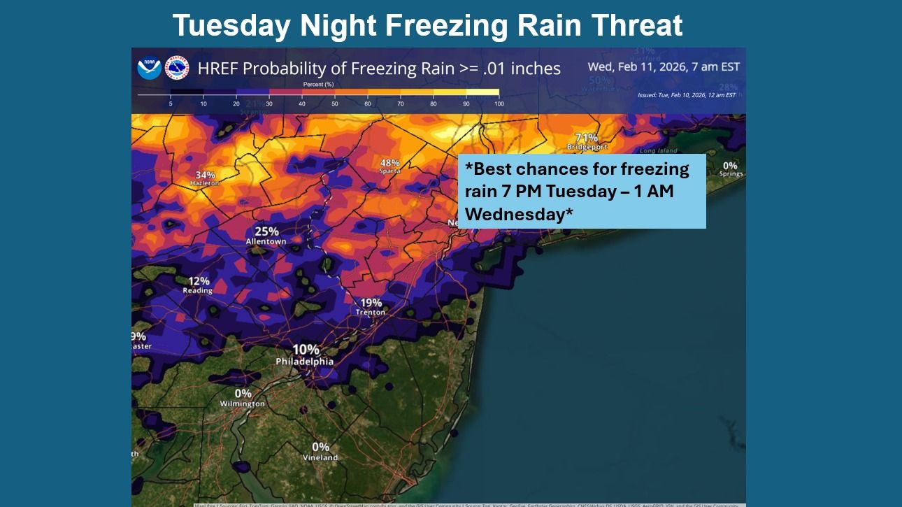
URGENT UPDATE: Freezing rain is forecasted to impact northern southeastern Pennsylvania and New Jersey tonight, with potential light icing expected into early Wednesday morning. The National Weather Service (NWS) has issued an alert indicating that the most affected areas will be primarily north of I-78.
Tonight, temperatures are projected to drop to around 28°F, creating hazardous conditions as light precipitation transitions from snow to sleet and potentially freezing rain. The NWS warns that “the forecast challenge is temperatures, precipitation types, and just how much precipitation is realized.” This means residents should be prepared for slick roads and reduced visibility.
The NWS details that the light icing may occur this evening, with the most significant impacts felt in the northern portions of southeastern Pennsylvania and New Jersey. As the precipitation persists, conditions will likely worsen, leading to treacherous travel conditions overnight.
Looking ahead, another winter storm is anticipated to move into the region this weekend, with the highest chances for precipitation set for late Sunday, January 14, into early Monday. Residents should monitor updates closely as the forecast evolves.
Weather forecasts for the coming days indicate mostly cloudy conditions, with temperatures struggling to get above 39°F on Wednesday. Winds will pick up, with gusts reaching up to 25 mph, further complicating commuting conditions.
As you prepare for these weather developments, ensure you have a plan for safe travel. The NWS recommends staying updated on forecasts and road conditions to avoid unexpected hazards.
Stay safe and share this information with friends and family to keep everyone informed on the impending weather threat.